Intense MN rains contribute to 6,700-square-mile Gulf dead zone

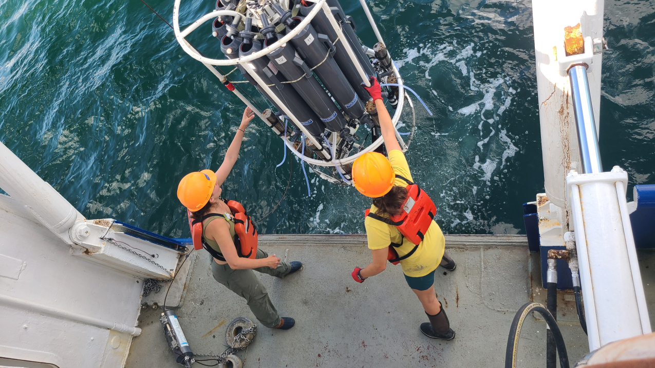
Scientists regularly forecast, monitor and measure the annual dead zone in the Gulf of Mexico. This photo shows researchers collecting near-bottom water to obtain oxygen measurements in 2024. (Photo by LUMCON/LSU, Cassandra Glaspie)
On the heels of one of the rainiest Minnesota springs and early summers in recent memory, many headlines focused on drought relief followed by the local impacts of extreme flooding.
But this unceasing precipitation has also contributed to a negative situation far downriver, at the mouth of the Mississippi.
This year's Gulf of Mexico dead zone — an area where oxygen levels in the water are so low that little, if any, marine life can survive there — measured 6,705 square miles, the NOAA announced Aug. 1. For perspective, that is more than double the size of the Twin Cities seven-county metro area and approximately the size of New Jersey. It's also the 12th-largest dead zone measurement on record.
This hypoxia (the term for low oxygen levels) is largely tied to river discharge (how much water is flowing downstream) and nutrient loading data (the amount of excess nutrients, particularly nitrate and phosphorus, in the water).
Which is where Minnesota’s spring-summer soaking comes in.
“In general, the size of the dead zone is tied to overall pollutant loads to the Gulf, which are closely correlated to river flows,” explained FMR Water Program Director Trevor Russell.
A dry year, he said, usually means a small dead zone (which we saw in 2023, for example). A wet year and the dead zone typically swells.
“There are other factors too,” Russell said, “but pollution from cropland and wastewater treatment systems, and overall river flow are key drivers of the dead zone.”
That is what is behind the above-average 2024 dead zone.

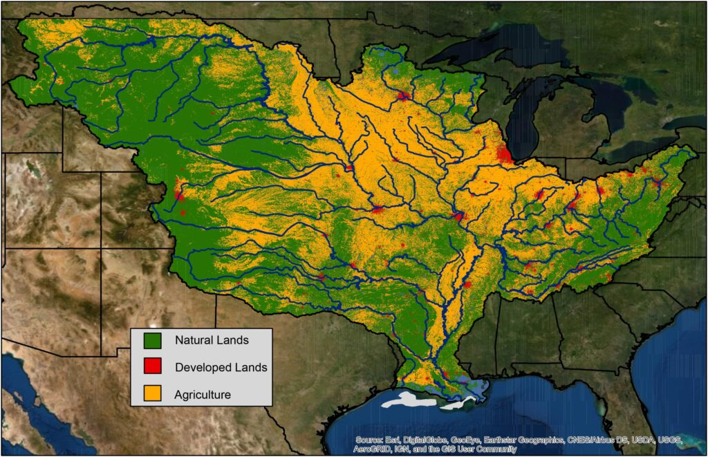
The Mississippi River and many of its main tributaries flow through large swaths of agricultural land, indicated by the yellow areas in the map above. (Photo by USGS via NOAA)
April and May saw rainfall levels significantly above normal throughout Minnesota, with both months making a strong push for one of the wettest springs on record, writes Mark Seeley for Minnesota Weather Talk. Areas around the headwaters of the Minnesota River — a major tributary to the Mississippi — had three times the normal amount of rainfall, he says. That trend continued into June, with major flooding seen throughout the state.
Clearly there has been quite a lot of water flowing into and down the Mississippi River. That matches what the NOAA had measured earlier this summer when it predicted a dead zone of 5,827 square miles, which is an above-normal river discharge.
Then there’s the nutrient loading data. The main culprits responsible for creating the conditions of the dead zone are nitrate and phosphorus. While these can reach the river in a few ways, the predominant source of nutrient pollution is agriculture.
The vast majority of Minnesota’s cropland is empty all through April and well into May. When water from heavy spring rains seeps into the ground or rushes across the landscape, it carries with it the nutrients and chemicals that are left over in the unprotected soil (aka the “big brown spot”).
“Nutrient pollution impacts water bodies across the country and in the Gulf of Mexico it has resulted in a dead zone, where low to no oxygen does not support fish and marine life,” said Bruno Pigott, acting assistant administrator of EPA’s Office of Water, in the NOAA's announcement.
That includes nitrate and phosphorus, which get swept into the creeks and streams and rivers that feed the Mighty Mississippi, and ultimately make their way to the Gulf of Mexico where they fuel this annual environmental catastrophe we call the dead zone.
"If we want to address the dead zone, if we want to clean up our drinking water, if we want to protect public health, then we need to address the big brown spot," said Russell. "The only way to do that is by providing farmers with clean-water crops that can ensure living cover on Minnesota farmland from fall through spring, and by making sure farmers can sell those crops for a profit. It’s a market-based, voluntary solution that would generate significant benefits for people and wildlife from here in the upper Mississippi River watershed all the way to the Gulf."
Become a River Guardian
Sign up and we'll email you when important river issues arise. We make it quick and easy to contact decision-makers. River Guardians are also invited to special social hours and other events about legislative and metro river corridor issues.


